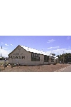
C.L. Alexander Museum

C.L. Alexander Museum

Local history of the district from 1880. Special sections on agriculture, entertainment, sports, marine, schools, churches, transport, household items, photographs, maps and books. The museum if also responsible for the care of Stokes Methodist Church and Pioneer Women's Memorial. Caretakers of the Provis Memorial Park. Markers at the sites of early schools and other places of historical interest. Listing of the heritage listed buildings in the area.

Address: 
52 Harvey Drive, Tumby Bay, SA
Tel: 
0886882760
Hours: 
2.30pm-4.30pm Fri and Sun
Admission: 
Adults $2, Children 20c
Facilities: 
Toilets, Wheelchair access, Reference books, Education and guided tours on application.
Collection: 
900 items, 450 photographs. Memorabilia of local - transport, churches, schools, shipping, shops, early settlers, agriculture, entertainment, hospital, war and various household items. Many books of district families and history, copies of Matthew Flinders' maps, letters and botanical drawings from the voyage 1803, original letters from pioneers, books of photographs. Saddle making, communications, various district and sporting photos and trophies. Council history and development. Room furnished with period furniture, as kitchen, laundry, sitting room and bedroom. Also clothing to match the period.

Items

Wardrobe

Carved Draws - Wardrobe
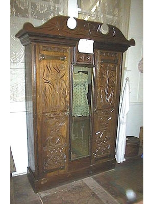
Carved Draws - Wardrobe
Creator:
A.S.M Lovell
Description:
Large wooden wardrobe with intricately carved doors. A.S.M Lovell crafted this wardrobe, during 1912-13, while headmaster of the Lipson School. Mr Lovell boarded with the family of Edward and Matilda Carr, and while there carved the doors for the wardrobe with a pocketknife. At the outbreak of WWW1 he resigned as a teacher and returned to England, leaving behind the wardrobe, which was later donated to the trust. He became a Colonel in the Army, but was killed during the war.
Date:
1912-13

Doors carved by pocketknife and left behind when - late col. Lovell returned to England to join WWW1 - He died at the war.

Bell

Church Bell

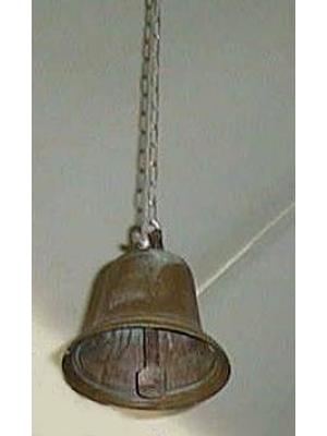
Church Bell
Description:
Small Church Bell, first at Wesleyan Chapel, Burrawing Mine. Later Church of England Church - Lipson. The copper lode discovered on Yorke Peninsula was believed by old miners to have extended under the Spencer Gulf, with the same balance of assay, reappearing near the Tumby Bay area. Opening the Burrawing Copper Mine at Lipson enticed miners from the "Copper Triangle", and with them came their firm Wesleyan faith. A chapel built in 1872 on a hill overlooking the mine. It was also used as a school, where pupils paid for daily attendance. The Church Bell was in use until the mine closed in 1876. People moved away and the church was no longer used, but as the small township of Lipson became more established, the Church of England built a church in the town. At the time of installation, the Bell from the Chapel was hung in the new church. There was a lot of very heated discussion in the district at the time. When eventually the methodist (Wesleyan) people built their church, the church of England decided against parting with the Bell. Incidentally now the Church of England has been decommissioned and the Methodist Church is still used, and the Bell resides at the National Trust in Tumby bay.
Date:
1872

Acquired by museum 1972

Booklets

Tumby Bay Sketch Books
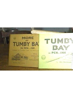
Tumby Bay Sketch Books
Creator:
Ken Whitford
Description:
Booklets of sketches - building, drawings - relating to the original drawings on display. "Some May Remember" extracts - "When I arrived with my parents in 1907 in the S.S. Investigator, the town was very much in its infancy. My father in partnership bought a saddler business, about 1908 the house and shop were demolished and the family moved in to the northern end of the new premises. For two years I worked at the trade in this shop. When we arrived it was a desolate looking area, sandhills, rushes and scrub, with only a few buildings scattered about. Lack of water was one of the most serious problems in the early days, Mr R Bratten's daughter, was caretaker of the government underground tank, with catchment roof, and water was sold for about one shilling (10c) per 100 gallons. It was a real transformation to visit and note the great changes after 55yrs." Mr Whitford returned toTumby Bay in his Later years and contributed much to the National Trust. He was a noted artist, and left a legacy of sketchbooks of the buildings and other drawings relating to the district. He is represented in the following galleries: Art Gallery of South Australia 7 works, Perth Art Gallery, Western Australia 1, Castlemaine Art Gallery, Victoria 2, Broken Hill Museum and Art Gallery NSW 1, Australia House London 1, Legislative Council, Adelaide SA 1, House Assembly, Adelaide SA 1, Australian National Gallery ACT.
Date:
1974

Ken Whitford - a noted artist who is represented in various galleries in Australia and Australia House, London.

Plough - Replica

Patent - Road Plough
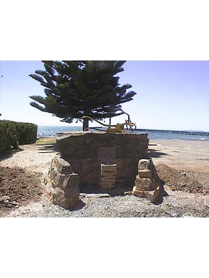
Patent - Road Plough
Creator:
Excell and Sons and A.W. Carr
Description:
Replica of Original Plough - scaled down model. Robert Bratten came to Australia from Ireland at the age of 20 years. He was appointed to the position of Overseer, in 1906 when the council received many petitions for new roads to be opened. Mr Bratten held this position for 20years. After initial surveys the first roads had to be made through scrub areas which were manually cleared, just tracks. Originally roads were macadamised by breaking big stones with a hammer until they were small enough to pass through a 2.5 inch ring. This sufficed until motor cars required stronger surface for speed and weight. Big sheet limestone was a problem so a special plough was designed to plough the stones to the surface, the larger ones disposed of, and the smaller ones curshed and used. First the road was formed by the grader and then rolled with a heavy roller. Geoff Ferguson patented the beams and slides that held the plough upright E.E. Excell and and Sons with A.W. Carr made a patented complete plough with beam and wheels, which made the plough more suitable for heavy work and transporting, with the capability of being towed by a tractor instead of horse drawn. This method was called Brattenising, this method of road making enabled a wide road to be made, especially in limestone country. Wide use of this system was introduced in various parts of the state, such as the Murray Mallee and Yorke Peninsula. A monument was erected on the foreshore at Tumby Bay in recognition, being constructed of sheets of stone, shaped to form a seat and at one time a water fountain. A model of the Plough is displayed on the top of the monument. The Excell Blacksmith Museum also has display and information.
Date:
1930

Original patented plough, papers of the patent at the museum. Information on the development of this - the road making, Brattenising and this with information about Robert Bratten.

Charts

Solander of Charts
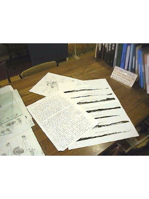
Solander of Charts
Creator:
Matthew Flinders
Description:
Copies of maps 1802-3 Voyage to Terra Australis. H.M.S. Investigator Recovery Expedition. 1972-3. Presented to the National Trust Branch of Tumby Bay, by Expedition Leader G.D. Seaton, to honour Mathew Flinders. The Solander conatins copies of charts mapped during the exploration with the HMS Investigator. "Voyage to Terra Australis, Flinders Charts" - the Australian coastal voyage, 1802-3, and also contain many botanical drawings depicted by Ferd. Bauer. Included with this are copies of letters written by Mathew Flinders to his mother at the finish of his voyage. Quote "Investigator Port Jackson June 10, 1802-3 - My dearest Mother, We arrived here yesterday from having circumnavigated New Holland". Tumby Island - named by Flinders matches the name of a village in Lincolnshire England. Later the bay was called harvey bay but the town is now known as Tumby Bay with the most Southern patch of mangroves supplying a breeding ground for the excellent fish nursery. The nearby island group off the coast "Sir Joseph Banks Goup" were named in honour of his Patron, with the various islands named after towns and areas in Lincolnshire.,

Mapping, Profile drawings of Australia, Botanical drawings, letters.